 Location Intelligence
CyberSWIFT’s Location Intelligence solution is a comprehensive set of offerings for location-based intelligence & analytics, mapping services, trend analysis, visualization, integration and much more. It allows you to enhance your business using location-based geographic market analysis of your offerings, promote your products & services, boost sales and get a better understanding of your customers.
Location Intelligence (LI) is the methodology of deriving insights using internal business data and external location-based data to solve specific business challenges that help in growing and optimizing your business. In addition to simple data visualization on maps, LI involves analyzing location data that are an integral part of a business. It is used to facilitate comprehensive planning, prediction, and problem-solving for your business.
Enhance Your Business With Location Intelligence
Market Analysis
Site Selection
Product Promotions
Sizing Competition

Sales & Performance Management
Identifying New Opportunities
Building Better Customer Engagement

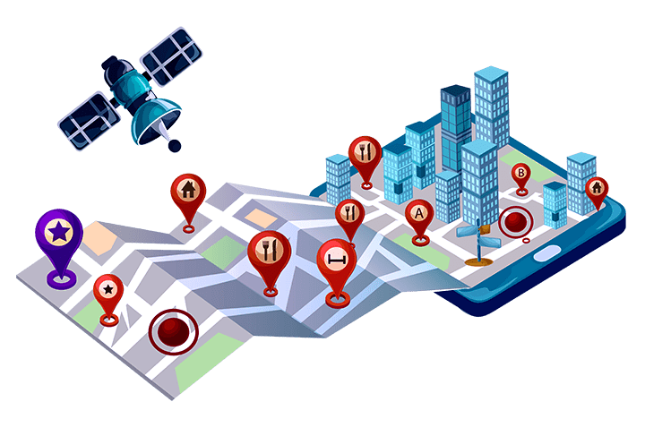
Location based analysis using GIS - A Game Changer
-
GIS, acronym for Geographic Information System is a discipline and technology that utilizes location to simplify and highlight trends that leads to make better decisions. Business intelligence and data mining are pretty popular among businesses. These systems help decision makers in pulling their business data into a central platform and draw patterns of good sales, bad sales, good customers, weak customers etc. and finally decide what category of people or offerings to target and set their strategy accordingly. But this still leaves a big gap.
Nearly 70% of your business data has a location element. These location elements can be addresses, zip codes, county, state, phone, IP address and so on. GIS makes use of such location elements in helping you identify and understand trends and stories about what may be transpiring and provide you a context of “why” in your business.
Effective GIS based intelligence and analytics not only shows the patterns of things (such as sales, product consumptions, inventory, etc.) with respect to locations, it also enriches you with information regarding your target market, places of interest, competitors, consumers and their lifestyles, interests, behaviors, etc. Basically it amplifies the phrase “A picture is worth a thousand words” to a whole different level.
Here is a glimpse of what it might look like. You can decipher trends in an instant that may sometime take long time to understand.
Here are some examples of benefits that Location Intelligence can provide
-
 Senior management and other company personnel can get a clear top down view of sales trends as compared to having to go through tons of data.
 -
 You can painlessly visualize your markets in an easy to use map and determine how they are doing, both at the macro level and at a detailed micro level.
 -
 You can flexibly visualize your top performing locations and get an idea about why they are doing better versus the ones that are weak.
 -
 You can easily visualize how much sales each of your regions, stores or zones are contributing.
 -
 You can see how your products or product categories are individually performing across your locations.
 -
 You can see how your sales is behaving across different time periods for specific regions.
 -
 You can see your customers on map and clearly say which area has given you most buyers so far. You can determine key characteristics of such strong buyers and target such buyers in other regions.
 -
 You can identify market overlaps and reduce the costs by merging/eliminating them.
 -
 You can have an insight on socioeconomic aspects and other demographic aspects of people in a given region to optimize your offerings.

FAQ
Location intelligence is used by a broad range of businesses and industries to improve overall business results. This includes:
- Retail: Market analysis, site selection, product market opportunity analysis, maximize per-store sales, identify under-performing stores, retail leakage and supply gap analysis.
- Real estate: Retail planning, demographic study, growth pattern analysis, site reports, in-depth site analyses, and presentation-quality maps.
- Hotels and restaurants: Analysis of customer profiles, site analysis, target marketing, and expansion planning.
- Government: Census updates, disaster recovery, law enforcement crime analysis, emergency response, environmental and land management, electoral redistricting, tax jurisdiction assignment, urban planning.
- Financial services: Branch location optimization, market data analysis, share of wallet and cross-selling initiatives, mergers and acquisitions, and sector analysis.
- Media: Target market identification, consumer response analysis, subscriber demographics, media planning.
- Healthcare: Site selection, health equity planning, market segmentation, network analysis, growth assessments, spread of disease.
- Higher education: Campus mapping, alumni and donor tracking, and student acquisition.
- K-12: School site selection, enrollment forecasting, boundary adjustments for school attendance areas, school fusion, and district.
- Insurance: Address validation, underwriting and risk management, claims management, marketing and sales analysis, market penetration studies.
- Communications and telecommunications: Network planning and design, boundary identification, identifying new customer markets.
- Consolidation, student achievement plotting.
- Transportation: Transport planning, route optimization, route monitoring.
With Business Intelligence, you can see the trends in data, and also potentially predict future directions based on the trends.
You may put things in a more geographic context when you use locational intelligence. You can observe what is happening in the world around you and how it affects your business, making informed predictions. This is what could be difficult to determine with BI. With LI approach, you can both see the bigger picture, as well as narrow it down to observe local dynamics and how it impacts your business.
Download Our Brochure
Have Other Questions?
We would love to hear about your bbusiness initiative & would also like to help design the module & share insights about how we can possibly help you using Location Intelligence Solution. We would also be happy to show you some of the ways we’ve helped customers to get where they wanted to go.
Request A Call Back